
NEXUS AI / GRID PLANNER
Drop a pin where the customer is. Get back a project in your GIS.
Grid Planner turns a connection request into a project. An engineer marks the point on the map; the pod builds the extension against the utility's own business rules, project standards and compliance rules, creates the project inside the GIS, validates it there, and leaves it ready for approval and posting.
Twelve seconds of the pod working. No sound, nothing to start, nothing to sit through.
Connecting a new customer is the most repeated design work a distribution utility does, and most of it is not engineering judgement. It is the same sequence every time: find the nearest point of connection, lay in the extension, apply the standards, check it against the rules, build the project, route it for approval. Done by hand each one occupies a designer for hours, and the backlog sets how fast the utility can connect anybody.
-
Place the connection point
An engineer marks the point on the map — a new customer, an extension, added load.
-
The extension is generated
Against the utility's own business rules, its project and construction standards, and the compliance rules it works under. Not generic defaults.
-
Review before it leaves
The generated design appears on the pod's own map, where it can be looked at before it goes anywhere.
-
The project is created in the GIS
Not a drawing somebody has to redraw — a project inside the utility's GIS, validated against that system's own rule set.
-
Available for approval and posting
It then moves through the utility's normal approval and posting process. Grid Planner makes it available; your process decides.
A new customer connection
The most repeated design job there is, collapsed to the part that needs a person: deciding where the connection goes.
An extension, or added load
Same sequence, same standards, same validation — without a designer rebuilding it from first principles each time.
A connection backlog that sets the pace
When the queue decides how fast anyone gets connected, the sequence that produces each design is the thing worth shortening.
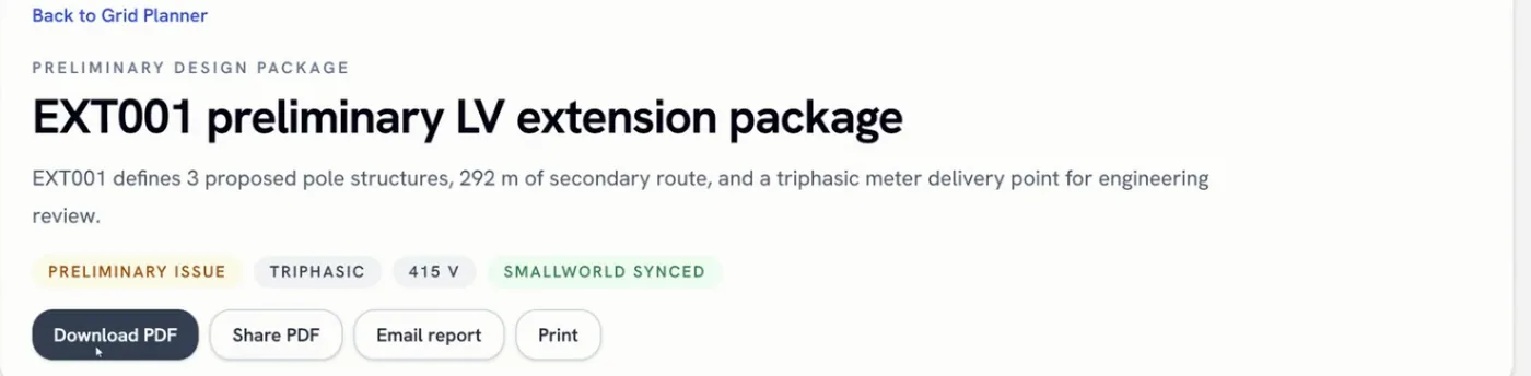
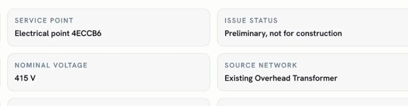
The preliminary design package, end to end.
Each connection is made by API or by a direct database connection, and is defined once rather than per project.
- The utility's GIS, through Gateway
- Direction: Read, and write — the project is created and validated there
- Spatial Studio
- Direction: Editing, export and import of generated designs
- Workspace
- Direction: Reports and indicators
| System | Direction |
|---|---|
| The utility's GIS, through Gateway | Read, and write — the project is created and validated there |
| Spatial Studio | Editing, export and import of generated designs |
| Workspace | Reports and indicators |
Where it stops
- Grid Planner makes a project available for approval and posting. Your own process runs the approval.
- It is the front door, not a replacement for anything in your GIS. What it produces is a project your GIS's own design and quality tools carry through.
- Compliance rules are yours. Grid Planner applies the rules you configure; it does not supply a regulatory regime.
- The pod carries a map sized for this job. Seeing the design against every other layer is what Spatial Studio is for.
Who can see what
People sign in with the corporate directory account they already have, and what they are allowed to see is enforced in four places: at the platform, inside each pod, on the map, and in the answers that come back to them.
Where it stands
Grid Planner is the front door — where the request arrives and the design is generated — and what it produces is a project your GIS's own design and quality tools carry through approval and posting.
Technical walkthrough · 8 min
See it in action — watch the 8-minute Nexus AI Platform walkthrough.
Recorded directly in the platform, with English narration and no slide deck. GIS, ERP, ADMS, and maintenance answering together, without replacing the systems you already run. The link arrives after you register.
Need to brief your leadership? The one-page brief
A technical session covers your estate, where the platform would run, and which pods come first.
Book a technical session